Semeru Mountain or called Sumeru is the highest montain in the java island. The stratovolcano is also known as Mahameru, meaning 'The Great Mountain. The name derived from Hindu-Buddhist mythical mountain of Meru or Sumeru, the abode of gods.
 |
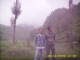
| Behind Background of clouds of the Semeru Mountain |
Geology
Known also as Mahameru the (Great Mountain), with its peak Mahameru, 3.676 meters above sea level (mdpl). The crater at the Summit of Mount Semeru was known by the name Jonggring Saloko. it is very steep rising abruptly above the coastal plains of eastern Java. Semeru lies at the south end of the Tengger Volcanic Complex.
Semeru have forest area, dipterokarp of a hill the forest dipterokarp upon, a forest of montane, an ericaceous and forest or woodland mountain.
The mountain is located between the administration area to the southeast of Malang and, with geographical position between 8 06 ' LS and 120 55 ' E.
 |
| The Crater Jonggring Saloko |
It takes about four days to climb the Summit of Mount Semeru round-trip. To climb Mount semeru is passing through the city of Malang or Lumajang city. From the terminal of malang we ride public transport to the village of Overlapping. Dialled again with the Jeep or truck Vegetables available at back of the overlapping terminal market with cost-per-person Rp. 20.000,-until the post Ranu Pani.
Whereas if you want try the other track, you may try from Senduro by motor cycle. I was passed this track. From the center city, then through until you find Senduro village. Find the direction travelling or ask to the local residents the way to the Semeru Muntain. Arround 2 hours from senduro then you arrive on Ranupane Village. In this village you will finding lake and variuos guide to the Semeru or Bromo mountain.
 |
| Rest on Front of Ranupani Village Officer |
Eruptive History
In late 2010 and early 2011 volcanic ash and incandescent material was thrown up by eruptive activity with a heavy rain of ejected volcanic material falling around the crater. Continuous eruptions on 21 January caused a thin ash fall mainly in the village area of Ngadirejo and Sukapura Wonokerto, Probolinggo district. The impact of the heavy rain and volcanic ash from eruptions during December 2010 and January 2011 resulted in disruption to normal activities and the local economy. The potential for long term environmental damage and health problems amongst the residents in the locality surrounding Mount Bromo was paramount at that time.
Due to high seasonal rainfall in January 2011 the potential for lahar (cold lava) and lava flow (hot lava) was elevated due to the deposits of volcanic ash, sand and other ejected material that thad built up. Activity was dominated by tremor vibration, eruption of ash plumes and ejection of incandescent material.
People living on the banks of the Perahu Ravine, Nganten Ravine and Sukapura River were alerted to the high possibility of lahar flows, especially if further heavy rainfalls occur in the area around Cemorolawang, Ngadisari and Ngadirejo. Eruptions and volcanic tremors were reported on 21 January and 22 January with activity subsiding on 23 January 2011.
The park was reopened to visitors in April 2011
 |
| Far End View Semeru Eruptions |
 |
| Near End Semeru Eruptions on 2004 |
 |
| Peak of The Mahameru Eruptions |
Bromo Tengger Semeru National Park is the only conservation area in Indonesia, which has the uniqueness of sea sand covering an area of 5,250 acres, which is at an altitude of 2,100 meters above sea level.
 |
| The Entrance Gate of The National Park of Bromo Tengger Semeru |
On the sea of sand found seven eruptive centers in the two paths that intersect the east-west and northeast-southwest. From the northeast-southwest of Mount Bromo is emerging that includes an active volcano which at times may issue an eruption of smoke and threaten human life in the vicinity (± 3500 inhabitants).
 | ||||
| Savannah Part of The National Park |
| Savannah on The Climb Part of The National Park |
 |
| Above of The Savannah Part of The National Park |
 |
| Wide View The Savannah Part of The National Park |
 |
| The Sea Sand part of The National Park |
Official Tourism Offices
- East Java Tourism Office, Jalan Wisata Menanggal, Surabaya, East Java, ☎ +62 31 8531815 or 8531820 (eastjava@indosat.net.id).
- East Java Tourism Office, Jl Jendral Basuki Rachmat 6, Malang, East Java, ☎ +62 341 323966.
- Office of the Bromo-Tengger-Semeru National Park, Jl Raden Intan No6, Malang, East Java, ☎ +62 341 491828 (tn-bromo@malang.wasan-tara.net.id).
http://wikitravel.org/en/Bromo-Tengger-Semeru_National_Park
http://en.wikipedia.org/wiki/Semeru
http://www.dephut.go.id/INFORMASI/TN%20INDO-ENGLISH/tn_bromo.htm
http://www.volcanodiscovery.com
http://www.flixya.com
http://www.flickrhivemind.net
